 |
 |
 |
 |
 |
 |
 |
 |
 |
 |
 |
 |
Creation Date: Circa 21st April
Map Ref: SU577999
Crop: Canola/Oil Seed Rape
Reported by: Crop Circle Connector Rumours
Image(s): By Geoff Ambler and by Ellis Taylor with Thanks (Click to enlarge
images)
Dimensions/Swirl: (Formation to be properly surveyed)
Description and Information:
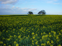
First reported April 21st 2005. The first Oxfordshire formation in rape for some years and again found within the Garsington/Toot Baldon "hot spot" although in a location not reported before. It is on high ground near to a 4 tall trees, but in May it could only be seen on the ground from the path next to 3 barns at SU 572997.
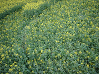
The formation consists of two features. The larger is a "galaxy" style circle with two spiralling arms and a tapering tongue of standing crop at the centre. This measures about 70ft diameter. About 100ft further to the East is a looping "S" shape which cannot be seen from distant views.
The crop is recovering rapidly but orginally looked to be heavily flattenend with few broken stems
More information can be found at www.ellisctaylor.com/cropcircles.html